Seven Best Washington Hikes

Let me begin by clarifying that this is a “Best Hikes of Washington” list, which is not to be confused with a “Top Hikes in Washington” list, and yes, there is a difference. At least in my book.
If I were to make a “Top Hikes in Washington” list it would include the most popular trails in the state, and while a few below are quickly gaining popularity you will not find them in AllTrails’ top 20 hikes by reviews. If that is what you are looking for, you won’t find it here. No Rattlesnake Ledge, no Lake Twenty-Two, no Wallace Falls. Sure, these are popular for a reason - they are easy to access and the view-to-effort effort ratio is ideal - however, I encourage those hiking in Washington to research other options, too. Why not give the popular trails a rest and go a little further for a hidden gem? Plus, trails are best at their most pure - devoid of garbage and crowds.
Now, I understand that making any list of the “best” things will be inherently subjective and vary from person to person based on experience and preferences. So what makes these hikes the “best” and who am I to claim they are?
My experience
As a Washington State native, I have the pleasure to call the Cascades my backyard. I’ve been hiking in the PNW for a little over ten years, though I became more serious five or so years ago. I dipped into the backpacking scene about three years ago and it’s now one of my favorite pastimes. All in all, I’ve hiked hundreds of miles all over the state and naturally a few have come to stand out.
What makes a trail “good”?
Each trail offers a unique experience whether it be outstanding views, the workout it gives, its great camping options, or a combination of these and other factors. It can even differ from season to season. The trails below are, of course, what I value most, but also what I would recommend to a friend or where I would take someone from out of town.
I love trails that offer crisp mountain views, colorful wildflowers and that are more open (as opposed to primarily under the forest canopy). If I can enjoy views throughout the whole hike, not just at the end, I’m all for it. If we’re getting technical, I tend to go for trails that are 6-10 miles and about 2000-3000 feet in elevation gain.
please note
For these hikes, I’ve linked Washington Trails Association (WTA) and AllTrails, which are fantastic resources for new and seasoned hikers alike. I find the former to be best for planning purposes and the latter most helpful while on trail (using their offline maps). Oftentimes the mileage and elevation gain varies a bit between the two and for the elevation gain on the list below I used my Apple Watch while hiking it myself. Of note: I like to count the elevation from start to finish, not just from bottom to top, since sometimes going back down can be a surprisingly uphill battle.
Lastly, a quick word
If you do go on these hikes, please - for the love of all things good and holy - be considerate of the environment and practice Leave No Trace principles. In short, pack out trash (even orange peels!), stay on trail and be respectful to other hikers around you. I enjoy sharing hiking recommendations but I also want to make sure I’m doing my part to protect the environment; sharing a few hikes alongside educational resources is my happy medium. That said, I believe the outdoors is for everyone and if you’re reading this now, you are hopefully doing your research for the hikes you’d like to go on, which is great.
Okay, the housekeeping is done! Let’s dig in!
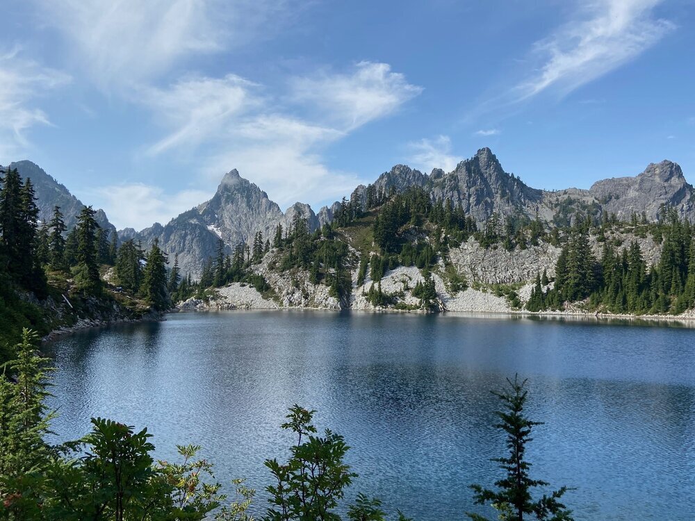
01. Lake Ingalls

Region | Alpine Lakes
miles | 9.0 (out/back)
elevation gain | 2860 ft
Difficulty | Moderate
For a day hike, this trail covers an impressive variety of ecosystems and terrain. You start with a short walk through the forest before emerging on a cliffside trail with consistent expansive views and wildflowers lining the path. At the fork, the choose-your-own-adventure fun begins. Here you can waltz through meadows (home to goats!) or go through the valley for a steeper, but more direct, route. Both will end at the lake, which is dominated by the ever-so-rugged Mt. Stuart.
Best for
Day hiking, mountain views, lake access, constant views
What to expect
Various ecosystems, goats (!), crowds and heat in summer, snow from November to July.
Pro tip
Fall is a great time to backpack this trail and be treated to larch madness.
02. West Foss Forks

Region | Alpine Lakes
miles | ~18.0 (out/back)
elevation gain | 5600 ft
Difficulty | Moderate - Hard
This trail is a well-rounded wonder: a true workout, incredible views, lakes galore, great camping, and - perhaps best of all - it’s quiet.
Sitting off the beaten path and often overlooked for its neighbor, the Necklace Valley, West Foss Forks River and Lakes offers a true backcountry experience. While there is a typical route followed, it is a trail that can be catered to various physical abilities and interests.
Early on, you hit Trout Lake, a popular spot for fishing (go figure). From there, gain some quick elevation to reach reach Copper Lake, which is where most day hikers turn back, or is a good place to camp if you are seeking an easy first day. I recommend chugging up to Little Heart Lake, which after a total of 5.6 miles and 3000 feet gain, is well earned. From there, choose your next ones: Big Heart Lake, Angeline Lake, or if you are ambitious and capable, Chetwood Lake. (Read more on my Trip Report on WTA.)
Best for
Multi-night backpacking, seclusion, epic scenery
What to expect
Pleasant weather from May to October, mosquitoes in summer, a solitary experience.
Pro tip
If backpacking, bring a small pack for day hikes.
03. Cascade Pass & Sahale Arm
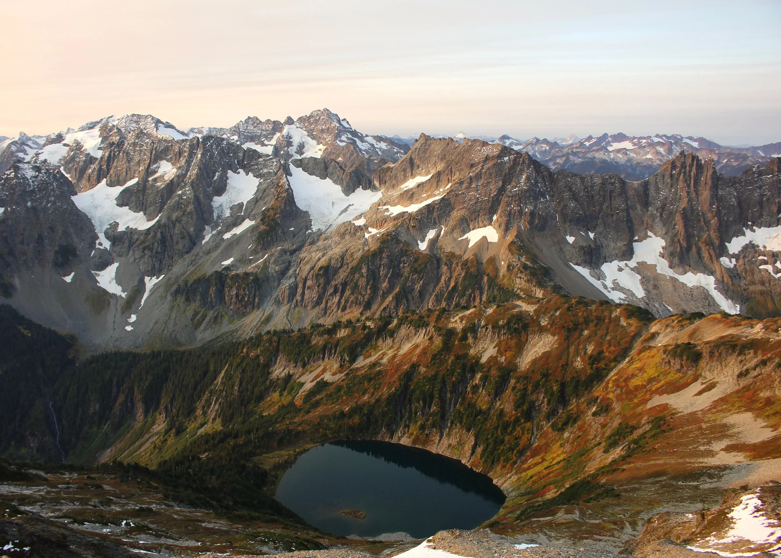
Region | North Cascades
miles | 13.0 (out/back)
elevation gain | 4240 ft
Difficulty | Hard
Perhaps it was the perfect weather, or the fall colors emerging, or the perfect spot for camping we had - but this hike is absolutely remarkable. After 36 switchbacks under the forest canopy, you emerge beside the Cascade Pass valley. From there, we made our way to Sahale Arm, a beautiful stroll across boulders and through meadows with jagged mountains serving as a backdrop.
While it can be done as a day hike, the true magic lays in staying overnight, which requires backcountry permits. Trust me, it is worth it. It may even be the most beautiful place I’ve had the pleasure of camping.
Best For
A long day hike, epic camping, fall colors, wildlife sightings.
What to expect
Possible bear sightings and, if going to Sahale Glacier Camp, be prepared for snow and technical terrain.
Pro Tip
Get a permit for early fall when the crowds are thinning and the colors are popping.
04. Park Butte Lookout

Region | Mt. Baker
miles | 7.5 (Out/back)
elevation gain | 2200 ft
Difficulty | Moderate
This trail is getting startlingly popular, but my affinity for it prevails and thus made it on the list. I love the openness of the trail and bright green meadows on the way to lookout, followed by the directly-in-your-face view of Mt. Baker.
As for camping, most aim for the lookout, but after sleeping there myself, I’d prefer some tent action in the meadow down below personally. There are lots of options, so if you don’t get the lookout, don’t sweat it!
Best for
Day hiking, overnight backpacking, wildflowers, serious mountain views
What to expect
Snow from late-September to mid-July (if snowshoeing in winter, be cautious of snowmobiles), a gentle climb that’s still a workout.
Pro tip
Make it a longer trip/overnight by exploring Railroad grade.
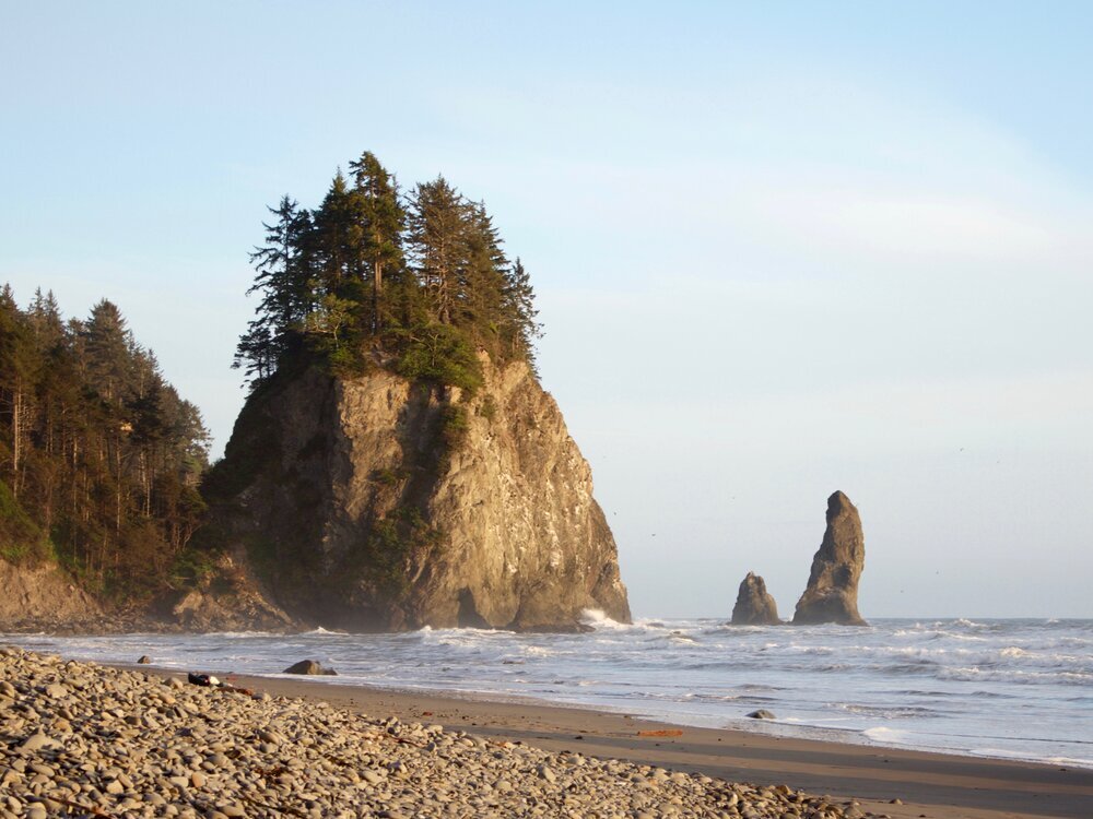
o5. South Coast Wilderness trail

Region | Olympics
miles | ~20 (end-to-end)
elevation gain | ~2000 ft
Difficulty | moderate
I know I’ve waxed poetic about this trail in other posts, but it’s just one of those hikes I won’t stop talking about. If that’s not an indication of its wonderfulness, I don’t know what is.
This trail takes you through forests, up cliff sides with ropes, down onto beaches with tide pools, and face-to-face with wildlife. Then you fall asleep to the sounds of waves crashing and everything in life is perfect. With the ample camping options, it’s really a DIY adventure and the distance and elevation gain can be easily varied.
This trail requires careful planning around the tides and other logistics, such as permits and bear canisters (for raccoons), which you can learn about in my detailed How to Plan the South Coast Wilderness Trail.
Best for
Multi-night backpacking, beach camping, wildlife (deers, whales, tide pools), constant views
What to expect
Cool temps, occasional rope climbing, headache-inducing trip planning (for the most worthy of causes)
Pro Tip
Ditch the poles, pack the camera.
06. Granite Mountain

Region | Snoqualmie
miles | 8.5 (out/back)
elevation gain | 3800 ft
Difficulty | Hard
With nearly 1000 feet of elevation per mile, this hike is demanding and your legs will likely whine about it (at least mine did…). But don’t worry, it’s all worth it. The constant views along the way keeps morale up and the wildflowers don’t hurt either. At the top, the reward is expansive views of the Cascades.
Like most trails these days, this one is also gaining popularity, primarily due to its proximity to Seattle (only an hour drive!), but the elevation gain deters many. As with most fire lookouts during the pandemic, it will not be open to the public, so don’t be too heartbroken when you can’t get in.
Best For
360° views, day hiking, wildflowers, an easy-to-get-to trail from Seattle
What to expect
Crossing a snow field or two even into June, a solid workout. If hiking in winter, have avalanche preparedness training.
Pro Tip
Poles are helpful, especially to save the knees on the way down.
o7. Mount Storm King

Region | Olympics
miles | 5.0 (out/back)
elevation gain | 2050 ft
Difficulty | Moderate - Hard
This is the definitely the busiest trail on the list, but for its overall greatness it’s hard to beat and hence made the cut.
What I love about this hike is that it is challenging, including cables to assist in reaching the top, and the epic scene at the top. After a sweaty climb, you are privy to a view of ultra-blue water, layers of mountains, and - if you squint - even Canada. When I do this hike I actually get texts saying that I’m in Canada, which I find endlessly amusing.
Best For
Day hiking, stellar views at the top, peek-a-boo views along the way
What to expect
A steep climb at the end via cables, a lot of heavy breathing and sweat, a long drive from Seattle.
Pro Tip
To avoid the crowds, go in the morning on a weekday.
Pin For Later:

You May Also Like: