Backpacking in Mt. Rainier National Park

Summary
Original plan, real plan
Getting there, getting ready
Skip ahead to plan your own hike


Things here

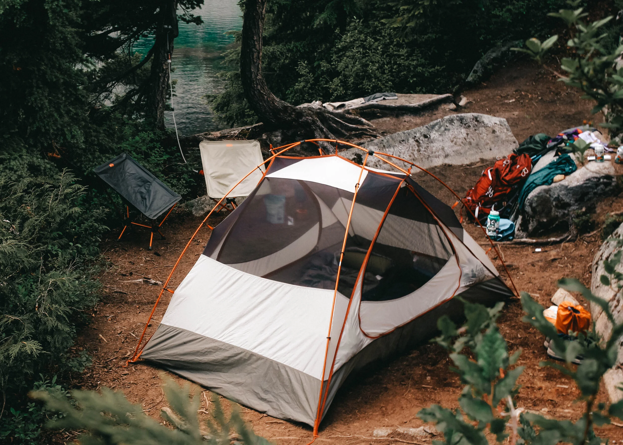
Day 1: Mowich Lake
0 miles | ↑ 0 ft / ↓ 0 ft
Overnight
And other stuff


Day 2: Mowich Lake — Ipsut Creek
8 miles | ↑ 780 ft / ↓ 3300 ft

Hiked about 8 miles
5.6 to Ipsut with a side trip to Eunice Lake (3 mils roundtrip). It was nearly all downhill, which was great with our packs on day 1. We went down into a valley with bautirfyul views and wildflowers, then through old growth forest, which felt like a rainforest. I normally don’t love the woods, but here, with the creek bubbling, the birds and the ecpanse of treesl it was very pleasant. I wish the others could have joined.
Our campsite was great. tall trees, plenty of space and close to the river. We tossed rocks at a Rainier can, played games, Marcel skunked me in cribbage, and 800 calories for lunch. The little grotto to bathe in was great. A good start!


Day 3: Ipsut CreeK — Yellowstone Cliffs
5.5 miles | ↑ 2800 ft / ↓ 65 ft

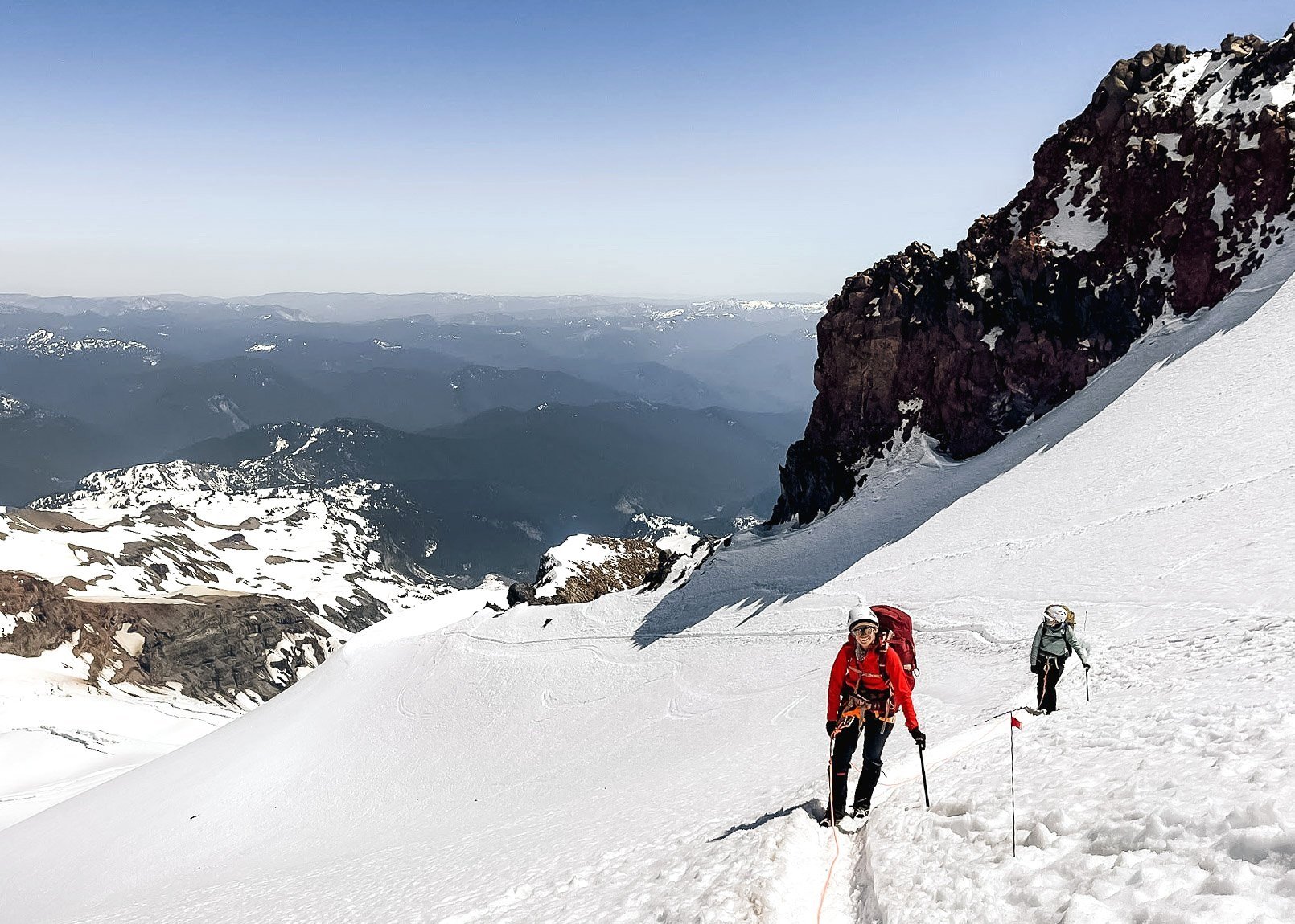
An uphill battle today. We crossed Carbon River over a series of logs that the rangers put together and then over rocks and log bridges. The river was very low. After that, we started our climb, 2800 feet over 2.5 miles a one point. for a total of 5.4 miles. The weather was cool, which was good for hiking but it’s cold at camp. Yellowstoneis in the woods at the base of towering vertical cliffs. Currrently, they are enshrouded by fog. After hiking, I felt warm enough to dunk in a little pool at the base of a small, rocky waterfuall and then we saw two adult deer with two fawns. Very cute.


Day 4: Yellowstone Cliffs — Fire Creek
8.2 miles | ↑ 2300 ft / ↓ 2700 ft

Tough day! Probably because of the thigh-burner yesterday settling into our bones. We left Yellowstone (actually saw the cliffs, too!) and walked through alpine meadows with mountain views—probably my favorite part so far. We descended, a lot I may add, and had an uphill climb that was sometimes gradual and long and other times short and quick. Camp is meh. It’s all in the forest and dark, despite it being our first sunny day. Hopefully we’ll see Rainier tomorrow. Tonight we played more games Padrita is a crowd favorite and got ready to head home in the morning. Today was 84 miles and it will be a little longer tomorrow.


Day 5: Fire Creek — White River
10.3 miles | ↑ 2400 ft / ↓ 2800 ft

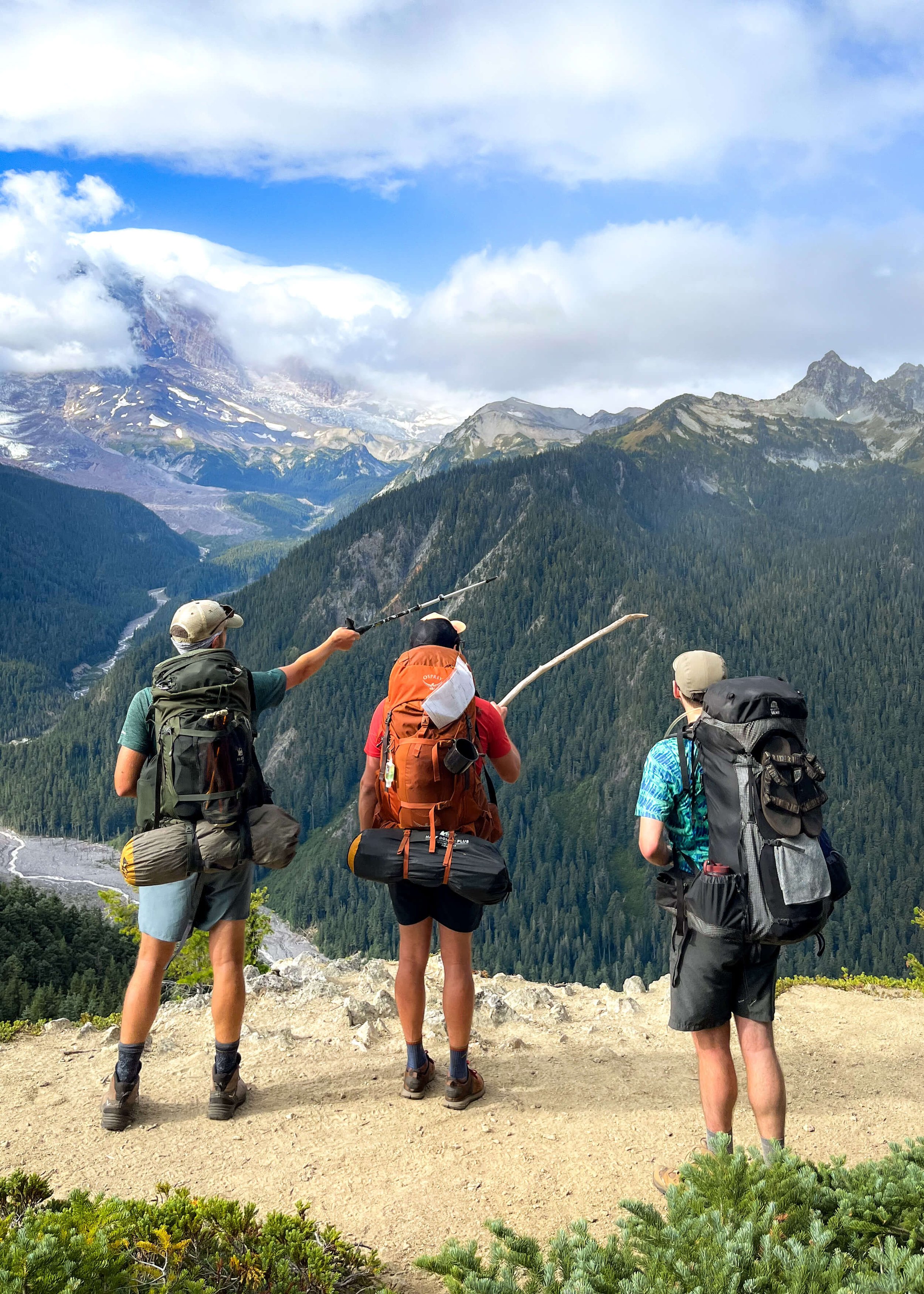
Final day of our wonderland-esque escape. It was 10 miles and a lot of downhill. First, we climbed 900 out of the tree-covered depths of Fire Creek and to a viewpoint of Rainier. From there, we meandered to Grand Park, a flat expanse with mountainous scenerey as a backdrop. It was like being plopped into Colorado suddenly. Rain followed us until Berkeley Camp—my favorite part—where a charming creek flowed through the meadow of bright green grass and wildflowers. We hiked out and around the rim of the bowl and to Sunrise. From there, we walked for what seemed like too long back to the car!


Plan your hike
DISTANCE 31 miles
ELEV. GAIN 8180 feet
ELEV. LOSS 8865 feet
LENGTH 4 days / 3 nights
AREA Mt. Rainier National Park
DIFFICULTY Challenging
PERMITS Backcountry camp permits, America the Beautiful entrance pass
Hiking Gear
Colchuck Lake is a popular hiking destination, there’s no denying that. There is a parking lot at the trailhead, including specified parking for overnight hikers with a permit, but expect difficulty in snagging a spot, especially on weekends.
Trailhead coordinates: 47.5277, -120.8210
Permits
To day hike in the Enchantments, only a NW Forest Pass is needed. To overnight between May and October, however, a lottery permit is required. They are strict about this and you can count on rangers coming through to enforce the rules.
Overnight permits are on a lottery-based system that occurs each spring through Recreation.gov. For your best shot at scoring one consider a smaller group size, choosing weekdays and/or selecting a less popular zone, like Colchuck or Stuart Lake. Good luck getting permits in the Core Zone on a summer weekend when everyone is chomping at the bit to be there, but give it a go anyway!
Resources
View more hiking details on Washington Trails Association for both Colchuck Lake and the whole Enchantments enchilada. You can also find information on AllTrails (Colchuck Lake, the Enchantments).
Last-Minute Tips
In summer, mosquitoes are horrendous. Bring bug suits, 100% deet spray, the works.
If hiking into the Core Zone, bring a water filter. You’ll use a ton of water and will likely need to refill.
Factor in time to stop for lunch and beers in Leavenworth after your trip!
Pin for later:

You may also like: